 When I was in high school, a friend and I drove his dad’s pickup onto a dry branch of the Canadian River. It seemed a great idea at the time: my friend’s church youth group was having a party/picnic along some small dunes on the riverbed after dark, with a bonfire, and driving the heavily loaded pickup to the site of the picnic would save a lot of effort toting drinks, hotdogs, ice, and other picnic supplies.
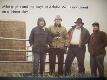
If you’re not familiar with dry riverbeds, think of rivers of sand that look hard-packed but aren’t, about fifty yards wide. The Canadian River, when I was growing up, was a stream ten to twenty feet wide, while the riverbed was a quarter-mile wide, bordered by rugged bluffs a few hundred feet high, which leaves a lot of room for sand, gravel, and a clutter of spindly trees, tall grasses, and bushes with thorns the size of my fingers. The branches coming out of the plains down into the river corridor were always dry. It didn’t take long to get the pickup stuck in the middle of the riverbed, some distance from the picnic site. It wouldn’t be until the next day that his not-very-pleased dad would come and drive it out. I don’t remember how the picnic got its supplies; I don’t even remember how we got back to town. To get to our destination, we had to have crossed a little used wagon path close to the bluffs, hidden amongst the mesquite trees, china berry trees, riverbed grasses, cactus, yucca, and other plants, as well as a proliferation of oil field roads, pipe lanes, and the rocking arms of oil well pumps. That we could have seen the wagon path at all was unlikely, but almost a hundred years before, in 1864, it was a highly traveled and significant road that, within twenty-four hours, would lead Kit Carson to the largest Indian battle of his career. A few weeks ago, I listed several of the historical “roads” that crossed Hutchinson County in the vicinity of the Canadian River where I grew up. I recently found another one, this one also of significant historical importance. Visiting the local historical museum, I bought a book titled Kit Carson and the First Battle of Adobe Walls, by Alvin R. Lynn. It is one of the most fascinating and informative books I’ve read in several years. Alvin R. Lynn is a retired social studies and science teacher, and was also a coach, in the Dumas, Texas, area, I believe. While researching a contribution to a Moore County history journal, in 1992, he discovered that a narrow strip of land following the Canadian River from one side of Texas to the other, had been a thoroughfare of activity for Native Americans, Spaniards, Mexican traders, buffalo hunters, California gold seekers, emigrants, and the military. In particular, he discovered that the strip included the route used by Colonel Kit Carson in his role as commandant of Fort Bascom (on the Canadian River, east of Conchas Lake in New Mexico), when he took a force of 335 soldiers east into Texas and fought one of the largest battles ever fought between Native Americans and the U.S. armed forces west of the Mississippi, involving as many as 3,000 Kiowa, Comanche, Apache, and Arapahos. The battle and Carson’s subsequent retreat was close to the ruins of the first Adobe Walls trading post (on the Canadian River, a few miles east Borger, Texas), a distance of about two hundred miles from Fort Bascom. This sudden interest into what seemed a remarkable void in historical literature and research, turned into a fifteen-year project that would take Alvin Lynn “driving about thirty thousand miles on highways and the backcountry of New Mexico and Texas; walking a few hundred miles through yucca, sagebrush, grass burrs, and other sticky plants; suffering the bites of gray-back deer flies, gnats, and mosquitoes; dodging a few rattlesnakes; enduring hot weather, cold weather, and winds that could blow the bark off cedar posts.” Having been allowed access to twenty-two different ranches along the way, Lynn used his trusty metal detector to locate, identify, and catalogue more than 1,800 artifacts. The location of those artifacts discovered or confirmed the locations of the major camps used by Colonel Carson while traveling to and from the battle site. Lynn’s research was accurately and thoroughly done, and the book is a great contribution to the history of the road, the major battle, and the various skirmishes that occurred over a two-day period. The battle, known as the First Battle of Adobe Walls (there would be a second and more famous one ten years later) was not a victory for either side. Carson was savvy enough to recognize that he faced a far greater enemy than he had expected, so he retreated from the area within the day that he had arrived, and made his way back to New Mexico along the same road he had taken to get there. If he had not brought along two cannons with him, his force might have been massacred. The major result of his campaign was that his men located and destroyed the Kiowa camp, burning more than 150 teepees, stores of dried meat, blankets, buffalo robes, powder, cooking utensils, and other supplies, including a buggy wagon that belonged to the Kiowa Chief. The battle occurred on Thanksgiving and the destruction of the camp left the Kiowas destitute for the start of winter. I am fascinated with the idea that it all occurred within miles of my house, and that what happened and exactly where it happened wasn’t explicitly researched until Lynn’s quest. I’m thankful for him and his book, and really wish that I had owned a metal detector in high school. Maybe I would have used it.
0 Comments
Leave a Reply. |
AuthorDon Willerton has been a reader all his life and yearns to write words like the authors he has read. He's working hard at it and invites others to share their experiences. |
 RSS Feed